
North Fork of the Shoshone -
On the way to Yellowstone
by K. ChristophersonIt doesn't get much more western than this - Teddy Roosevelt, Buffalo Bill, grizzlies, elk, mountains. Why not flyfish a river that has been flowing through history for eons?
The North Fork of the Shoshone River has its birthplace in the Absorakas, on the fringes of Yellowstone National Park. It travels many miles of gorgeous western country before meeting with its sister, the South Fork, at Buffalo Bill Reservoir. Fortunately for us, much of this river is available for flyfishing - some easy access and some difficult.
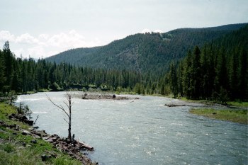 |
Reasonable access and good size make this river a great destination |
What kind of trout would you like to seek? Various parts of the river hold Yellowstone Cutts, Rainbows, Browns, Brookies, and Cuttbows.
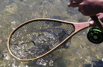 Nice rainbow
This part of the country is historic as the birthplace of preservation for our lands. Teddy Roosevelt, when visiting, called the route along the river, "the most scenic 52 miles in the country". The Shoshone Forest was the first National Forest. Yellowstone was the first National Park. And the region is steeped in Native American history and tradition.
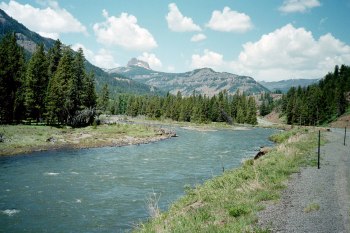 A view towards Yellowstone
Access:
Several access points are available along Hwys 14/16/20 en route to Yellowstone. They include
- Northern Cody - on north side of town, off 12th Street, about 1.5 mile easement.
- Trout Creek - Go about 14 miles west, past Buffalo Bill Reservoir. Turn south on Cnty Rd 6KV, traveling south then west. Access at Wyoming G&F and BLM properties on south side of river
- Wapiti - Travel about 17 miles west on Hwys 14/16/20. Two access points, one just west of Rivers Rest Resort. They other is BLM, accessed by turning east on Cnty Rd 6FU and going about 1/4 mile east to river
- Livermore - About 21 miles west of Cody, turn north on Cnty Rd 6CU Go about 1/2 mile north and turn west. Access is on south side of the river.
WY G&F website showing list of access for above areas
There are also many campgrounds (CG) and some picnic grounds (PG) along the river, accessed of Hwys 14/16/20. They are generally open from Memorial Day through September. There is a fee for camping and some campgrounds only allow hard-sided trailers because of grizzly bear problems.
- Horse Creek Picnic Area - 27 miles west of Cody
- Big Game CG - 28 miles west of Cody
- Wapiti CG - 29 miles west of Cody
- Clearwater CG - 31 miles west of Cody
- Rex Hale CG - 36 Miles west of Cody
- Newton Spring PG - about 37 miles west of Cody
- Newton Creek CG - 37 miles west of Cody
- Eagle Creek CG - 45 miles west of Cody
- Sleeping Giant PG - 47 miles west of Cody
- Three Mile CG - 48.5 miles west of Cody
Map of Shoshone Nat'l Forest campgrounds and picnic areas
Beyond this, as the river departs from the highway at Pahaska (where Buffalo Bill Cody established some cabins). There are pack/hiking trails following the river and its tributaries into the Absoraka Wilderness.
Be "bear aware" whether you are camping at an established campground or hiking into the wilderness. Loads of information about grizzly bears is available, so that you can know what to take, and what to do, about encounters with bears.
Traveling with friends or family? There's plenty for them to do in the area, or in Cody, whilst you enjoy a day on this historic, and great, river!
Rules and Regs and other stuff:
- Check WY G&F for regs. There are limits on trout and portions of the river are closed in the spring (from Newton Creek downstream to protect spawning cutts and rainbows).
- Some very interesting history about Buffalo Bill and Cody, including vintage area photos, can be found at the Wyoming Tales and Trails website